
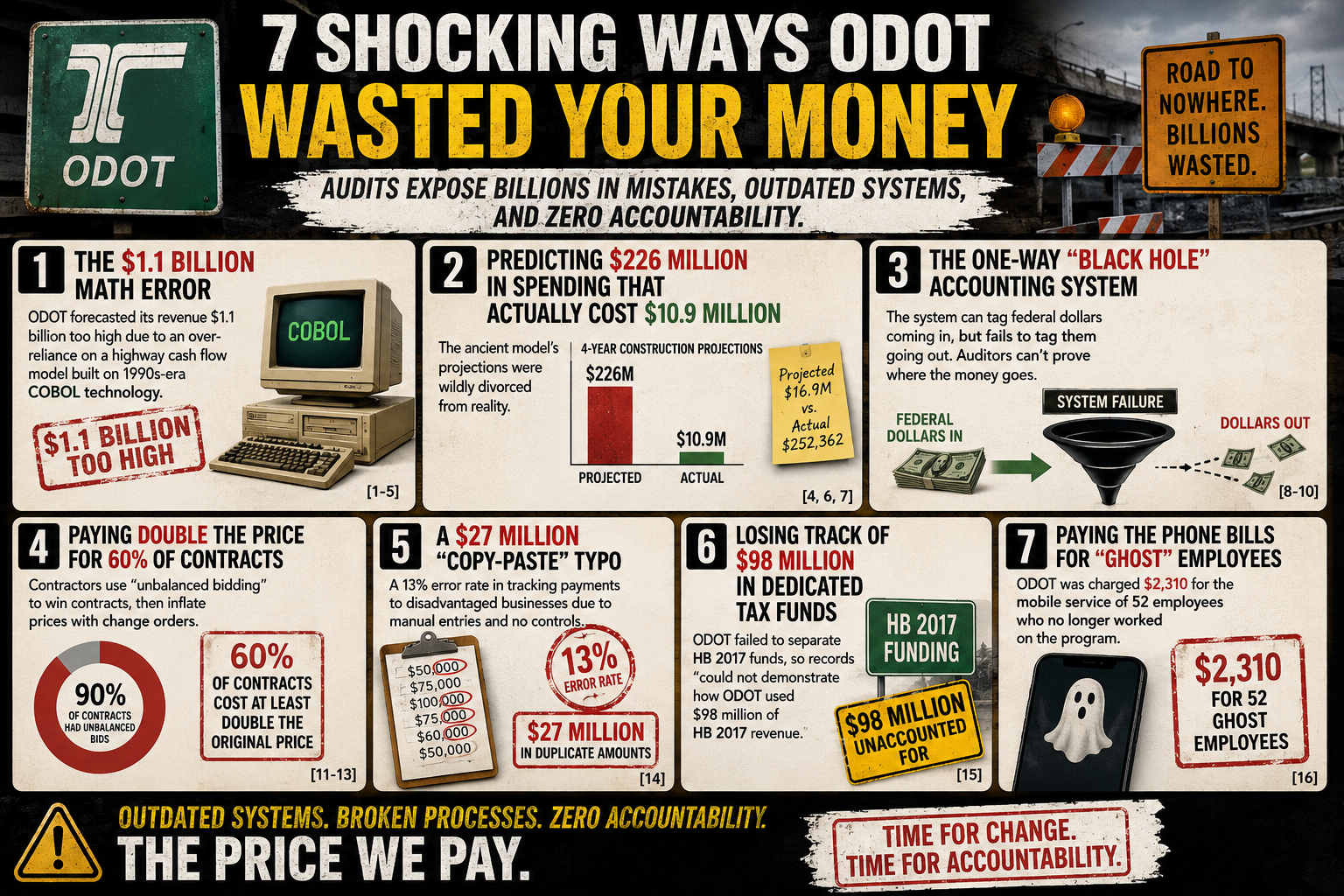
Jaw-Dropping Audit Finds From the 2025 ODOT Audit
Federal auditors had to issue a catastrophic "disclaimer of opinion" because ODOT's accounting system physically cannot prove where its federal grant money goes.
ODOT Subcontractor Payment and Oversight Processes: An Overview of Audit Findings
The audit found a noncompliance rate of 25% based on an allowed 15-day window ...Among the payments that were not made timely, the wait times ranged between 16 and 89 days.
When the Check is Always 'in the Mail': The Systemic Failure of Prompt Payment Oversight
audits of the Oregon Department of Transportation (ODOT) revealed a prompt payment noncompliance rate of roughly 25%, with some small businesses waiting up to 89 days to get paid
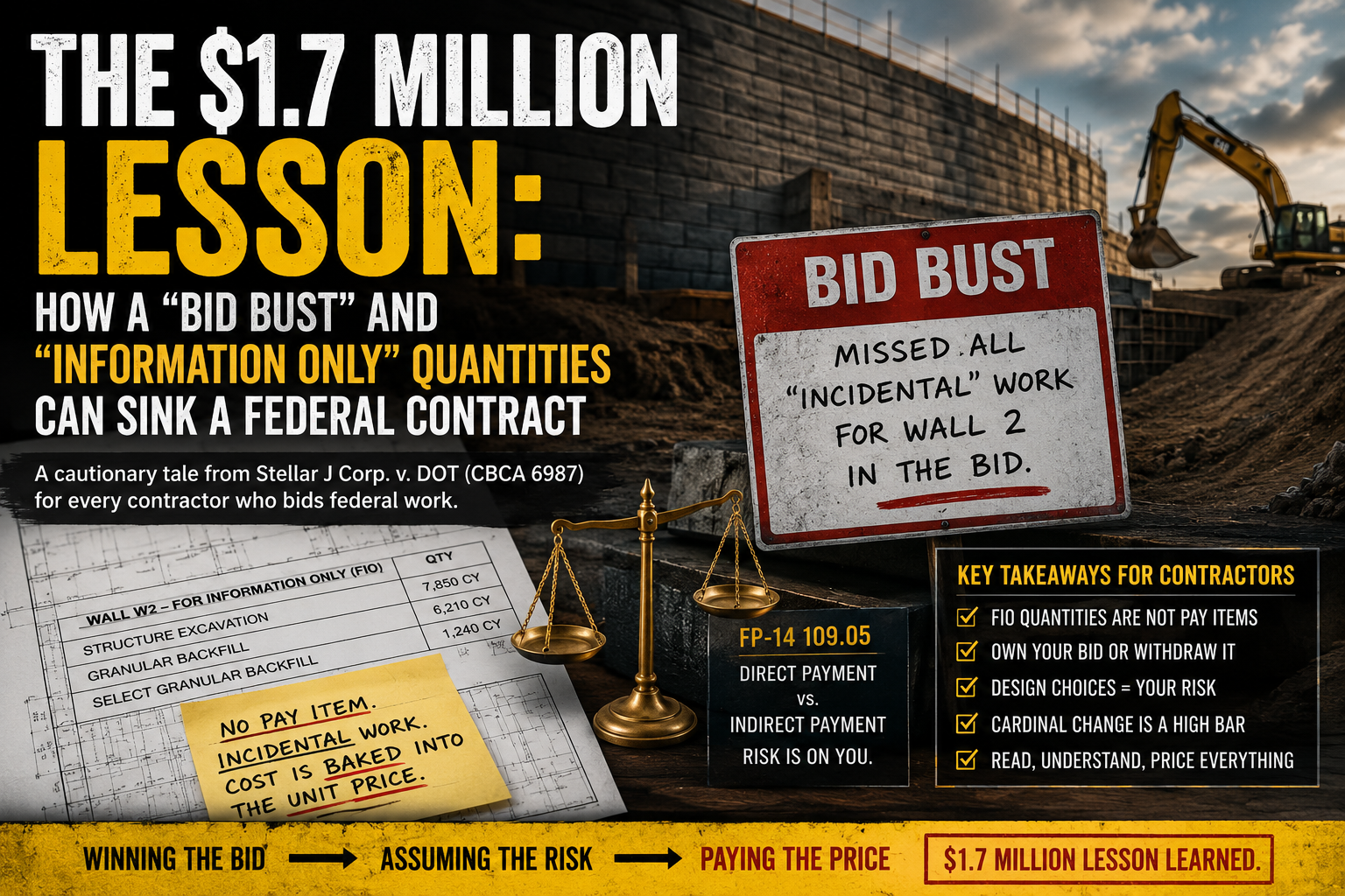
The $1.7 Million Lesson: How a "Bid Bust" and "Information Only" Quantities Can Sink a Federal Contract
Winning a public contract by a mile can feel like a victory — until the numbers reveal you didn’t win the job, you bought the risk. In Stellar J Corp. v. DOT, a contractor’s $22/SF bid for an MSE wall
The $27 Million Data Ghost: 5 Surprising Truths Behind Oregon’s Infrastructure Oversight
Government Gone Wild May 27, 2026 Public infrastructure is more than just concrete and steel; it is the lifeblood of our communities. Behind the massive highway expansions and bridge repairs lies a complex financial ecosystem designed to ensure that the “little guys”—the subcontractors and small businesses—are protected. This transparency is the only thing standing between…
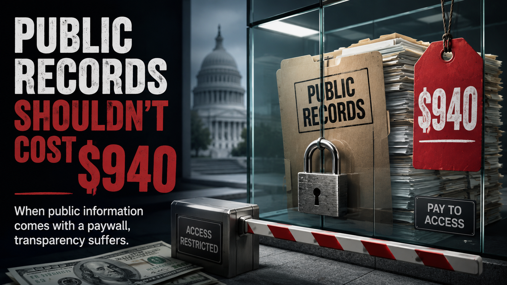
Public records belong to the public. So why are ordinary people charged hundreds of dollars just to see how taxpayer money is spent?